 I liked this one. The dog was playing fetch with a guy in a boat, but every so often the dog would decide to take a break on shore or on his own little island.
  I liked this one. The dog was playing fetch with a guy in a boat, but every so often the dog would decide to take a break on shore or on his own little island.
 These are the ends of a large group of trees buried and fossilized, and now exposed in the walls of the Salt River's canyon.
 This waterfall is still running because of overnight rain here. It'll be gone soon, leaving only the black streak of minerals marking its course.
 Canyon Lake is the second lake upstream on the Salt River from Phoenix. The lake is surrounded by mountains and some of them are 500 feet of sheer rock on one side, like this one...
 78 degrees and 83% humidity at 6:00 AM. A week before it was 99 degrees at the same time.
 Lightning strikes from a pretty good thunderstorm Tuesday night...
 Homeward bound we stopped at the Cameron Trading Post for the night. This was taken off the balcony of the motel. Downstream a few miles this canyon becomes more than a thousand feet deep and quite narrow before it meets with the Grand Canyon just north of the Desert Tower.
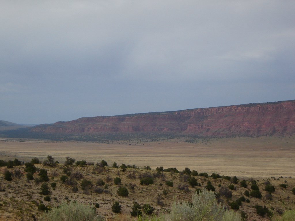 Coming east from Jacob Lake there's a nice grade off of a plateau (the Kaibab?) into the valley of the Colorado and its tributaries. This valley is miles across, and the wall goes on for most of the horizon.
 In places the sandstone has eroded like thick slate, with slabs spalling off and coming out in shelves like these. The trees get whipped around pretty good in the canyons and on the plateaus of the area.
 Coming out on the east side of the tunnel the first thing you see is that the country is much different. There are great sweeping lines in the sandstone and the whole feeling is much closer than the soaring peaks in the valley. You can get close up to this stuff.
 This is called "blind" because it's not opened. The dimensions escape me but it's something on the order of 550 feet across.
 These were just hanging out near the car. There were small wildflowers throughout the park.
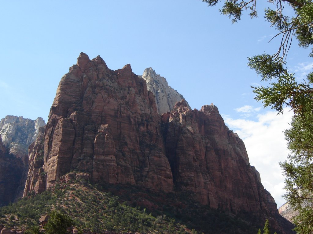 This is part of the Court of the Patriarchs. They really are impressive formations and they go up forever.
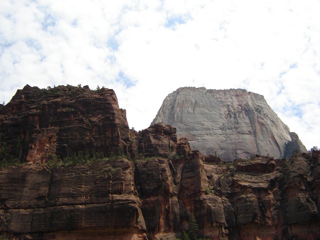 I have to tell you, I don't see a throne in this. I see a suggestion of a temple in some of the formations in the Grand Canyon, but this looks like a big flat-topped chunck of sandstone.
 This is about a mile upstream from the end of the road, and as far as you can go without getting your feet wet.
 The sandstone above lets the rain and snowmelt flow until it hits shale and then the water runs out in seeps and small waterfalls. The moisture allows a variety of plants to grow on the face of the rock, forming hanging gardens.
 That far plateau is over 11,000 feet above sea level - the highest plateau in North America. The picture doesn't do it justice because the coolest thing about it, at least from my view across the valley, is the way the white section on top gleams when the sun hits it.
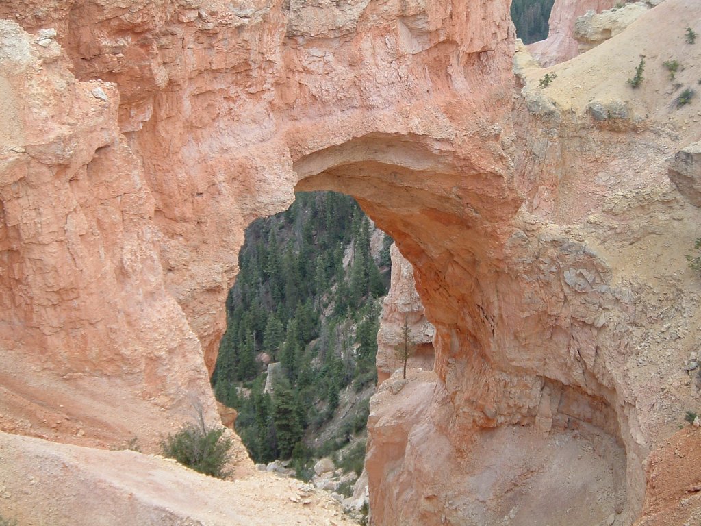 Or over-sized window, since the folks at Bryce make a point to differentiate natural bridges as being created by stream flow (but then they go ahead and labeled it the Natural Bridge viewpoint anyway!)...
 This was taken from the Rainbow viewpoint at the end of the road in Bryce Canyon. In addition to the hoodoos in front, you can see the sweep of the amphitheater rim.
 There are a couple of these as you head up Red Canyon toward Bryce Canyon National Park. Red Canyon has hoodoos like Bryce, but instead of looking down from the rim, you look up at them.
 This looks south toward the Glen Canyon Dam and the elegant bridge that is anchored to the sheer walls of the canyon. Page, AZ, is in the background. Whatever the merits of building the dam, it's a heck of a piece of engineering.


